
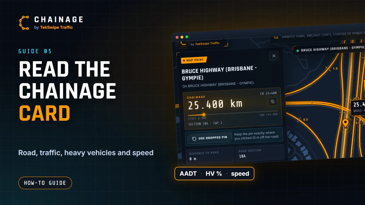
Whenever you find a chainage, by GPS, a tap on the map, search or a link, the chainage card shows everything Chainage knows about that point. On a computer it's the panel on the left. On a phone it slides up from the bottom: tap the grabber bar at the top or the ✕ to close it.
Title and badge
The title is the road name, or Dropped pin, or “Not on a Main Roads Queensland road”. The line under it explains the result, for example how far the pin snapped. The coloured badge says how you got there:
| Badge | When you see it |
|---|---|
| On a road, Near a road, Too far, No road nearby | Live GPS. See Find your chainage with GPS. |
| Map point | You tapped or clicked the map and the pin snapped to the road. |
| Dropped pin | The pin stayed where you put it, off the road. |
| Search result | You went to a chainage from search or the card. |
| Shared location | You opened a shared link or pasted coordinates. |
| Council road | The road is a council road. See Council roads. |
The chainage readout
- Chainage (or Nearest chainage for a dropped pin) in kilometres to 3 decimal places, for example 25.306 km. The copy icon next to it copies the value.
- CH 25+306: the same chainage as kilometres plus metres.
- A progress bar from START 0.000 to END (the section length) showing where the point sits along the road section.
- A line such as SECTION 10A · CWY 1. For a dropped pin it adds how far away the road is, for example 45 M AWAY. Council roads show the council's name and road ID.
The facts
| Field | What it means |
|---|---|
| Pin latitude, Pin longitude | Where a dropped pin is (dropped pins only). |
| Distance to road | How far the point you picked is from the road line. |
| Road section | TMR's ID for the stretch of road, for example 10A (Council road ID on council roads). |
| Carriageway | Which carriageway the chainage is on. See Road sections and carriageways explained. |
| Section length | The full length of the road section (Road length on council roads). |
| Traffic (AADT), Heavy vehicles | Vehicles per day and the heavy-vehicle share. See Traffic volume and heavy vehicles. |
| Latitude and longitude | The point you tapped, clicked, shared or your GPS position. |
| GPS accuracy | How accurate your GPS fix is, for example ±5 m (live GPS only). |
Values with a small pin icon can be tapped to show where the figure comes from. For the traffic figures, that's the TMR count site and the stretch of road its count stands for; tap the site's marker for its counts by year and by hour. See See the count site.
Speed limit and More information
The Speed limit box shows the nearest TMR survey speed sign straight away. More information (Live speed limit · heavy vehicle access) adds the live OpenStreetMap speed limit and NHVR heavy-vehicle access. See Speed limits and heavy-vehicle access.
The action buttons
- Save chainage point or Save dropped pin (Sign in to save this point when you're signed out). See Save a point to a project.
- Make a chainage range from this chainage. See Mark a stretch of road with a range.
- Chainage photo (while live tracking). See Take chainage-stamped photos.
- Street View. See Check the spot in Street View.
- Google Maps, plus Google route and Apple route when a road was found, and Copy coords. See Copy coordinates and get directions.
- Share. See Share a location.
At the bottom, Find another chainage on this road jumps to any chainage on the same road. See Go to a chainage on a road.